
Materials and methods
Study area
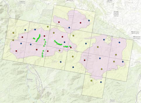
The study area is located at Northern Pindos National Park (NPNP) in Greece, based around “Vasilitsa” mountain and extends over an area of 375 km2. It was chosen for this study because it is a site of proposed wind farm development. The total study area consists of fifteen 5km × 5km grid cells and comprising of “Vasilitsa” and “Orliakas and Tsourgiakas” mountain massifs and their surrounding areas.
Camera trapping
The study was carried out for almost four months, between August 31st and December 20th 2020, using fifteen IR wildlife camera traps. One camera trap was positioned in each grid cell and three site rotations within each grid cell were implemented to maximize the probability of detection (Fig. 1).
Telemetry data collection
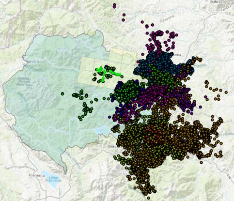
Telemetry data from a total of 14 bears wearing GPS collars was collected between 2004 and 2008 in areas adjacent to the camera trapping study area, inside or overlapping NPNP (Fig. 2), where the elevation, land cover and other geographical characteristics of the surrounding areas are similar.
Responsible for this page:
Director of undergraduate studies Biology
Last updated:
05/17/21